allow a precise enough estimation of the potential of wind
energy resource in a particular territory.
The measurements of wind speed at sites 1 and 2 were
carried out using certified sensors of wind speed and
sensors indicating the direction of air stream. All
measuring sensors are arranged on metallic masts with
heights of 53 and 60
m
above the ground [2].
For storing information from the sensors at all height
levels, a measuring complex NRG LOGGER Symphonie
9200 (measuring complex Symphonie) was used. The
complex has an independent energy supply from batteries
and it stores average wind speed values for every 10
min
intervals from nine sensors on its flash memory card.
Wind data retrieving and filtering from both sites was
done using NRG Symphonie Data Retriever. Further data
analysis was done using Microsoft Excel with additional
scripts, WRPLOT View – Lakes Environmental Software
and Natural Power software. The installation of the 60 m
high mast with the measuring complex Symphonie is
shown in Fig. 2.
Fig. 2: Installation of the 60
m
high mast with a measuring complex
Symphonie (Ainazi, site 2).
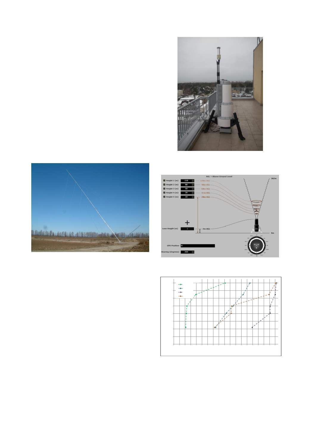
At site 3, for measuring the wind speed the optical
remote sensing complex ZephIR is used, which can
measure the wind speed and direction at a distance. The
complex ZephIR shown in Fig. 3 is installed on the top
floor of an eight-story apartment building and has a direct
connection to power grid and internet. Site 3 is located
800
m
from the sea coast and at an elevation of 42
m
above the Baltic Sea level. Figs. 4 and 5 show the
interface of wind speed measurement complex ZephIR
for configuration of height levels and the results of
measuring the wind speed with a 3-second integration for
each height, which highlight the process of forming a
pattern for the wind speed distribution in dependence on
the time of measurements.
The Wind Rose obtained from complex ZephIR data
at 160
m
height for the measurement time
T
(06.2011/05.2012) is shown in Fig. 6. From the diagram
it could be seen that the main energy stream is brought by
the south-north wind from the Baltic Sea side, with the
average wind speed at a height of 160
m
being
V
avg
= 9.66
m/s
.
Fig. 3: Optical remote sensing complex ZephIR for measuring wind
speed and direction at a distance up to height 160
m
on five height
levels (located in Ventspils, site 3 near the Baltic Sea coast).
Fig. 4: The user interface of Waltz software allowing configuration of
height levels for wind speed measurement complex ZephIR.
Fig. 5: Wind speed distribution at heights from 44
m
to 160
m,
obtained
for a short time span (24
h)
using software of complex ZephIR. Points
on the curves are updated in real time and correspond to the minimum,
maximum, mean and latest wind speed for all levels.
0
20
40
60
80
100
120
140
160
0 1 2 3 4 5 6 7 8 9 10 11 12 13 14 15 16 17 18
Height (m)
Wind speed (m/s)
Min
Mean
Max
Latest
Ventspils, site 3
2013 International Conference on Alternative Energy in Developing Countries and Emerging Economies
- 615 -


